Regione Toscana
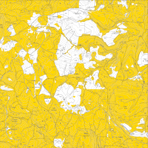
Regione Toscana - Aree ammesse all'intervento SRA - ACA18 "Impegni per l'Apicoltura” PSP 2023-2027
Individuazione delle aree ammesse all'intervento SRA ACA18 "Impegni per l'Apicoltura” PSP 2023-2027.
La perimetrazione è stata approvata con Delibera di Giunta Regionale n. 1285 del 11-11-2024 e Decreto Dirigenziale n. 26131 del 26-11-2024.
default
metadataInfo
- gmd:characterSet
- UTF8
- organisationName
-
Regione Toscana - Settore Sistema Informativo e Pianificazione del Territorio
- electronicMailAddress
- gmd:dateStamp
- 2025-05-08
- gmd:metadataStandardName
-
Linee Guida RNDT
- gmd:metadataStandardVersion
-
2.0
identificationInfo
- gmd:date (Creation)
- 2024-10-04
- gmd:date (Publication)
- 2024-10-04
- gmd:date (Revision)
- 2024-10-04
- organisationName
-
Regione Toscana
- electronicMailAddress
- datasetcode
-
r_toscan:f84d49e5-0cb8-4293-9ebc-4d12a58d6479
descriptiveKeywords
-
GEMET
-
-
agricoltura
-
apicoltura
-
freeTextKeywords
- keyword_libera
-
PSP
- keyword_libera
-
Aree ammesse alla misura ACA 18
- keyword_libera
-
RNDT
- keyword_libera
-
EU
- organisationName
-
Regione Toscana - Settore Sistema Informativo e Pianificazione del Territorio
- electronicMailAddress
- organisationName
-
Regione Toscana - SETTORE "Produzioni agricole, vegetali e zootecniche. Promozione. Sostegno agli investimenti delle imprese agricole e agroalimentari"
- electronicMailAddress
rndtDataConstraints
- gmd:useLimitation
-
no conditions apply
accessConstraints
- gmd:accessConstraints
- Other restrictions
- gmd:otherConstraints
- no limitations to public access
useConstraints
- gmd:otherConstraints
-
La risorsa è liberamente accessibile e usabile con licenza CC BY
extent
spatialSection
))
Dataset e serie
metadataInfo
hierarchyLevel
identificationInfo
- gmd:presentationForm
- mapDigital
- gmd:issueIdentification
-
r_toscan:f84d49e5-0cb8-4293-9ebc-4d12a58d6479
descriptiveKeywords
keyword_inspire_theme
keyword_ambito_territoriale
keyword_opendata
- keyword_opendata_label
-
opendata
- gmd:characterSet
- UTF8
- gmd:spatialRepresentationType
- Vector
- spatialResolutionScale
- 10000
topicCategory
- gmd:topicCategory
-
- farming
- gmd:supplementalInformation
-
Cod.RT: 178 - ACA18 - f84
extent
verticalSection
dataQualityInfo
- gmd:level
- Dataset
positionalAccuracy
- gco:Record
- 2.5
topologicalConsistency
topologicalConsistency
lineage
- gmd:statement
-
I poligoni delle aree di intervento ammissibili per l’ubicazione degli apiari sono stati individuati nell'ambito del LPIS (Land Parcel Identification System), di cui al regolamento Reg. (CE) 2-12-2021 n. 2021/2116/UE e attuativi Reg. (CE) 31-5-2022 n. 2022/1173/UE e Reg.(CE) 4-5-2022 n. 2022/1172/UE (fonte ARTEA), e corrispondono a quelli individuati all’interno della classificazione relativa al Refresh – Aggiornamento del SIPA-AGEA VI ciclo da cui sono stati estratti mediante query i seguenti codici:
638-PRATO PERMANENTE (SENZA TARA).
650-BOSCHI,
654-PASCOLO MAGRO (TARA 50%),
659-PASCOLO MAGRO (TARA 20%)
Il layer fa riferimento alla Delibera di Giunta Regionale n. 1285 del 11-11-2024 e Decreto Dirigenziale n. 26131 del 26-11-2024.
conformitySpecifications
referenceSystems
rsFieldAnchor
rsFieldCCS
rsFieldCode
dataDistribution
gmd:distributionFormat
- format
-
ESRI Shapefile
- format_version
-
1.0
- organisationName
-
Regione Toscana - Settore Sistema Informativo e Pianificazione del Territorio
- electronicMailAddress
onlineResource
- gmd:onLine
- access point ( WWW:LINK-1.0-http--link )
- gmd:onLine
- access point ( WWW:LINK-1.0-http--link )
- gmd:onLine
- access point ( Web Map Service (WMS) )
resourceMaintenance
Servizi
metadataInfo
- gmd:hierarchyLevel
- Dataset
serviceIdentification
serviceType
couplingType
operatesOn
operatesOn
dataDistribution
- gmd:onLine
- access point ( WWW:LINK-1.0-http--link )
- gmd:onLine
- access point ( WWW:LINK-1.0-http--link )
- gmd:onLine
- access point ( Web Map Service (WMS) )
servicesQualityInfo
qualityLevel
- gmd:level
- Dataset