Regione Toscana
Regione Toscana - Scuole Miur
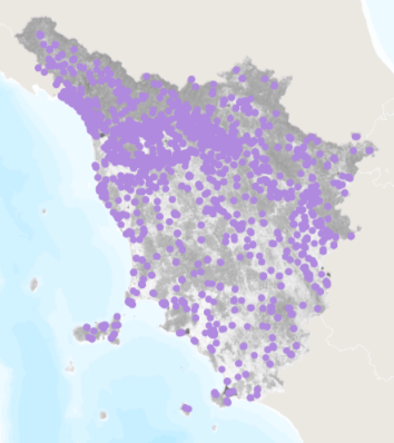
Localizzazione delle scuole del territorio della Regione Toscana
default
metadataInfo
- gmd:characterSet
- UTF8
- organisationName
-
Regione Toscana - Settore Sistema Informativo e Pianificazione del Territorio
- electronicMailAddress
- gmd:dateStamp
- 2025-01-14
- gmd:metadataStandardName
-
Linee Guida RNDT
- gmd:metadataStandardVersion
-
2.0
identificationInfo
- gmd:date (Revision)
- 2013
- organisationName
-
Regione Toscana
- electronicMailAddress
- datasetcode
-
r_toscan:2a4980a4-49be-4a0f-89d5-6fcf27c5f9cb
descriptiveKeywords
-
GEMET
-
-
ambiente urbano, stress urbano
-
scienze sociali
-
aspetti sociali, popolazione
-
edificio
-
scienze umane
-
sito d'interesse classificato
-
pianificazione edilizia
-
sensibilizzazione del pubblico
-
struttura edificata
-
freeTextKeywords
- keyword_libera
-
EU
- keyword_libera
-
RNDT
- organisationName
-
Regione Toscana - Settore Sistema Informativo e Pianificazione del Territorio
- electronicMailAddress
rndtDataConstraints
- gmd:useLimitation
-
no conditions apply
accessConstraints
- gmd:accessConstraints
- Other restrictions
- gmd:otherConstraints
- no limitations to public access
useConstraints
- gmd:otherConstraints
-
La risorsa è liberamente accessibile e usabile con licenza CC BY
extent
spatialSection
))
Dataset e serie
metadataInfo
hierarchyLevel
identificationInfo
- gmd:presentationForm
- mapDigital
- gmd:issueIdentification
-
r_toscan:2a4980a4-49be-4a0f-89d5-6fcf27c5f9cb
descriptiveKeywords
keyword_inspire_theme
keyword_ambito_territoriale
keyword_opendata
- keyword_opendata_label
-
opendata
- gmd:characterSet
- UTF8
- gmd:spatialRepresentationType
- Vector
- spatialResolutionScale
- 10000
topicCategory
- gmd:topicCategory
-
- planningCadastre
- structure
- gmd:supplementalInformation
-
Cod.RT: 116 - ScuoleMiur - 2a4
extent
verticalSection
dataQualityInfo
- gmd:level
- Dataset
positionalAccuracy
- gco:Record
- 2.5
topologicalConsistency
topologicalConsistency
lineage
- gmd:statement
-
Il dataset deriva da un elenco di edifici scolastici fornito dal MIUR. Tali elementi sono stati individuati e georeferenziati utilizzando anche la CTR 1:10000. Ai suddetti elementi è associata una tabella statistica, sempre fornita dal MIUR, che fornisce informazioni sulle caratteristiche delle singole unità.
conformitySpecifications
referenceSystems
rsFieldAnchor
rsFieldCCS
rsFieldCode
dataDistribution
gmd:distributionFormat
- format
-
ESRI Shapefile
- format_version
-
1.0
- organisationName
-
Regione Toscana - Settore Sistema Informativo e Pianificazione del Territorio
- electronicMailAddress
onlineResource
- gmd:onLine
- access point ( WWW:LINK-1.0-http--link )
resourceMaintenance
Servizi
metadataInfo
- gmd:hierarchyLevel
- Dataset
serviceIdentification
serviceType
couplingType
operatesOn
operatesOn
dataDistribution
- gmd:onLine
- access point ( WWW:LINK-1.0-http--link )
servicesQualityInfo
qualityLevel
- gmd:level
- Dataset